


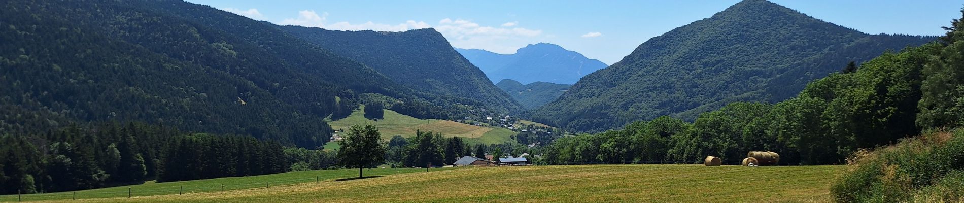
L'EMEINDRA / HABERT DE CHAMECHAUDE

ReneTeppet
User
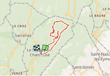

Length
17 km

Max alt
1595 m

Uphill gradient
839 m
Km-Effort
28 km

Min alt
1002 m

Downhill gradient
839 m
Boucle
Yes
Creation date :
2025-06-29 06:55:43.281
Updated on :
2025-06-29 12:52:07.144
5h27
Difficulty : Very difficult

FREE GPS app for hiking
 SityTrail
IGN / Geographical institutes
SityTrail Plus
The world is yours!
About
Trail Walking of 17 km to be discovered at Auvergne-Rhône-Alpes, Isère, Le Sappey-en-Chartreuse. This trail is proposed by ReneTeppet.
Photos


Positioning
Country:
France
Region :
Auvergne-Rhône-Alpes
Department/Province :
Isère
Municipality :
Le Sappey-en-Chartreuse
Location:
Unknown
Start:(Dec)
Start:(UTM)
718017 ; 5015393 (31T) N.
Comments